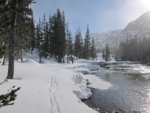
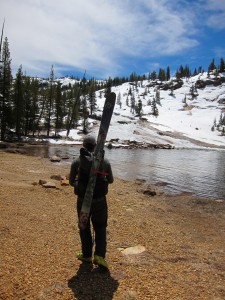
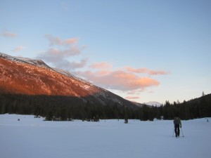
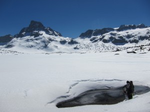
Pepper and I started skiing from Highway 108 near Sonora Pass, CA on April 15. The highway was still closed for the season so the trip began with a roadwalk up to snowline. It was an interesting trip, as you can see from the trip updates pasted below, due to the low snow year. However, it was still a great trip and a good learning experience incorporating a lot of new skills and equipment. The JMT/PCT corridor, which I followed for the second half of the trip was fantastic for a long distance ski trip. I finished the trip heading out Kearsarge Pass on April 29, skiing probably about three quarters of the roughly 250 miles from start to finish. Below are the updates and some pictures.
Final Update (4/30/13)
I got back home last night after completing the Sierra Ski Trip. All in all, despite the lack of snow this year, this was a great trip and really good experience to get my gear and systems dialed for this type of travel. In two weeks and over 250 miles, there was a mixed bag of conditions and terrain to try everything out on. This ranged from walking across dirt patches with our skis on, to hiking in our ski boots, scrambling through house-sized talus with some class 4 and low class 5 moves in ski boots, to actually skiing. Boot fit for all of these conditions is the single most important lesson that I have learned, since I wasn’t expecting these conditions and who knows what you will encounter.
During the past week, the conditions improved greatly since the majority of the time was spent over 8000 feet elevation. Up high in the lakes basins and heading up to the high passes the conditions were optimal. The skiing was fantastic and the lakes were still frozen, which made for direct lines, good glide, and little side-hilling, not to mention fun, slightly out-of-control downhills. At times, especially in the afternoons, I would relish in the fact that I had skis on. Knowing that if I were hiking I’d be postholing every step. In skis I was able to stand in places that I knew I would ordinarily posthole, and not budge an inch. It was great! Other times, especially in the mornings, I knew I could be moving faster by walking on the firm snow and straight up a steep uphill. Sometimes I’d strap the skis on my back and bootpack. Overall when the snowpack is covering this much terrain, I’d have to say it is faster to ski. By the last week, my body was feeling good and used to the motions, so an average of about 20 miles per day was not out of the question, including a few 30 mile days. At the beginning of the trip, we were hard pressed to get 15 miles in a day. In the last week, basically following the Pacific Crest Trail/John Muir Trail corridor through the High Sierras, I went over 8 high passes, covered about 130 miles, and broke another camera. I am not sure how but right after the last town stop in Mammoth the camera lens stopped working. Bummer, but that is the life of a long distance hiker. This is probably the fourth or fifth camera that I have had break in the backcountry. Other than the camera breaking, a few big blisters, and a couple of painful bruises on my achilles from the ski boots (which were bothersome enough to end up requiring Vitamin I treatment the last few days), the trip was fun and the scenery was amazing. It was great to see the Sierra extra early in the season with all of their Nevada.
A few days ago I saw bear tracks at 8500 feet elevation. The terrain was completely snow covered still, so I was very surprised to see this so early in the season. I have been wondering what the bear was doing up there since there obviously wasn’t much food yet. It is a light snow year but it seems very early in the season for it to be heading to that elevation.
I think that’s all for now. Time to go get some Ben and Jerry’s.
Update from Mammoth Lakes, CA (4/22/13)
Pepper and I pushed hard yesterday to get to Mammoth Lakes, CA. We are getting organized and resupplying now for the next stretch. We skied into town under headlamps and moonlight in a ~30+ mile day. We camped a few miles south of Tuolomne Meadows in Yosemite the night before and had the most favorable conditions of the entire trip while heading over Donahue Pass and Island Pass. We even had some pretty good turns and corn snow on the descents. I only wiped out once on the descent, which is saying a lot considering I am using leather tele boots and 3‑pin bindings with no heel bail (this set-up was the toughest decision for a weight conscious hiker—added control/performance vs. weight). I don’t regret my decision now at all considering the snow conditions have been less than optimal. Below 8000 feet elevation it is a mixed bag. We have had to bushwack through thick brush with our skis on our packs, make our way through talus fields with house sized boulders in our ski boots, and hike at least 15 miles of clear, snow-free trail in our ski boots. We should be higher mist of the way through the next section, but we have still decided to add the burden of carrying a lightweight pair of shoes just in case. The first couple of days were chilly and snowy. The weather has now transitioned to full-blow sunshine and intense solar radiation. At times I notice that I am still squinting despite wearing sunglasses. The fords have been cold, with ice often flowing in the rivers, but none too overwhelming. The biggest thing is the lack of snow. At times we are forced to zig-zag around to stay on snow instead of being able to travel a straight line. All in all, the trip is going well. We have covered about 110 miles now and are excited to get into the Sequoia-Kings Canyon National Park tomorrow. From here on out we are anticipating staying more on the Sierra High Route than the Pacific Crest Trail/John Muir Trail due to snow conditions and the higher elevations that the SHR maintains.


